to improve usability, I Love Rio uses cookies
by continuing to browse it you agree
to our privacy policy and our terms of use.

continue              exit

Pictures of Rio de Janeiro attractionsPicture of I LOVE RIO logo Pictures of Rio de Janeiro attractions Pictures of Rio de Janeiro attractions Pictures of Rio de Janeiro attractions Pictures of Rio de Janeiro attractions


at a glance

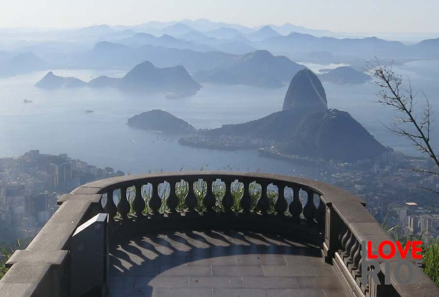
discovered by the portuguese, in 1502, the bay was originally mistaken for the mouth of a river, which is what gave the city the name of rio de janeiro, as 'rio' mean river, and 'janeiro' means january, the month of the discovery. home to some of the most famous sites of the region, the bay connects rio de janeiro to neighboring city, niterói via its landmark 13 kilometers long rio-niterói bridge, which is one of the highlights of the bay.

with a surface area of nearly 400 square kilometers, the bay has a 130 km perimeter and measures between 28 to 30 km form sides to sides, with the entrance into bay facing the ocean and 1700 meters wide.

the bay formed at the end of the last ice age, when the ice sheet melted and left water in its place, causing the bottom of the bay to be muddy, as it remains to this day. the mud at the bottom is also due to the domestic discharges, and the fluvial sedimentation of the 6 rivers that flow into it,  contributing to the dark color of the water. arrow-back     arrow-forward

landmarks
attractions nature
beaches mirantes
sports cultural
entertainment historical
music museums
nightlife churches
restaurants military forts
shopping monuments
etiquette neighborhoods
carnival events
réveillon oceanic islands bay islands lakeside islands other islands sporting
accommodations islands parks & gardens Pictures of Rio de Janeiro attractions folklore
transport beaches forests urban
safety waterfalls bio & eco reserves near rio de janeiro
extras lakes & lagoons mountains & caves top 10
      - home - about - © - terms of use - photos - privacy policy - contact - join - eu amo rio - products -